
When we were young, my cousin and I were always planning trips. One was a journey to the Tawases by bike from southeast Michigan. The other was a paddle down the Huron River. We figured each would take four days or so, and we’d camp along the way.
While we ended up taking the trips together only in our imaginations, you can kayak the Huron River and a lot more. Michigan now boasts a 3,000-mile network of water trails — state, nationally designated, or local routes — many of which are in areas you may not expect.
There are nine state-designated water trails, most of them in southern Michigan, several nationally designated routes, and so many other local routes that it’s hard to keep count. Here are just a few favorites you can try.

Southeast Michigan
Planning for designated trails in southeast Michigan got underway in earnest in the early 2000s, says Anita Twardesky, a former president of the Downriver Linked Greenways who was also involved in developing the 32-mile Detroit Heritage River Water Trail. Both are now chaired by Mary Bohling, interim district director with MSU Extension.
The Detroit waterway was declared an American Heritage River in 2001 under the U.S. Environmental Protection Agency’s guidelines established in the 1990s. It was an easy leap from greenways to include the river itself, which is divided into nine easily handled sections adventurers can explore. Twardesky’s favorite is the route around Belle Isle.
Bohling agrees. “You’re in the middle of this huge urban area and you’re still able to kayak the Detroit River, even with all the (big freighter) shipping activity,” Bohling says of the intermediate-rated trail. “It does take more experience, so only (people who aren’t novices) should attempt it.”
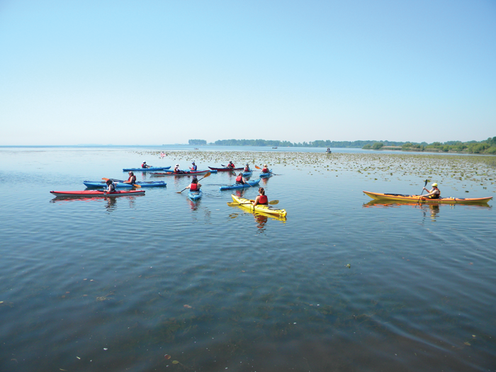
The 104-mile Huron River is another nationally designated water trail, running from its mouth at Lake Erie Metropark to Oakland County. “Again, you’re really close to a major metro area, but it feels like you’re up north,” Bohling says.
Katie Stepp, marketing manager for the Blue Water Area Convention & Visitors Bureau, and former City of St. Clair harbormaster and boat rental owner, suggests checking out the 10-mile, intermediate-rated Island Loop Route in the St. Clair River, a national water trail. She recommends getting on the trail on the Black River, upstream at Bakersfield Park. The Black River Canal is immediately opposite the park.

“You go right into the canal, which is absolutely beautiful in summer. People say they feel like they’re in the Amazon. The sidewalls are high and you can hear all the birds and experience nature at its best,” Stepp says.
As long as a special gate to protect against wind-driven water is open, you’ll pass into Lake Huron. Stop for a swim at Lakeside Park and beach, then glide by Michigan’s oldest lighthouse. You’ll tackle currents under the Blue Water Bridge, the St. Clair River’s narrowest point, and turn into the Black River proper past the Great Lakes Maritime Center to return to the park.
“If you happen to go under the bridge when two freighters are passing, it’s pretty incredible,” Stepp adds.

Northern Michigan
The 42-mile Chain of Lakes Water Trail is one of nine designated state routes recognized by the DNR.
Deana Jerdee is trail executive director of Paddle Antrim, which looks after the trail and offers biweekly community paddles, paddle classes for adults and children, and invasive species training. It also sponsors the annual September Paddle Antrim Festival, which last year brought 200 craft, from kayaks to paddleboards, to the waterway. Jerdee says one participant stand-paddled the entire way.
“The Chain of Lakes Water Trail started in 2014,” Jerdee says. “We’re actually on a lake system, so you can start at one point and return. It connects 12 lakes in Charlevoix, Antrim, Kalkaska, and Grand Traverse counties, so you can go over 100 miles from Charlevoix County to Grand Traverse Bay,” she explains.

Paddle Antrim sells waterproof maps and has a digital map online. The route is divided into lower and upper areas by a dam on the Intermediate River at Bellaire. Signs both on roads and on the water denote access sites, and there are designated campsites for longer trips, plus guidelines for beginner to advanced-level paddlers along each section.
Jerdee says one stretch in particular is her favorite: the upper chain, made up of St. Clair and Six Mile lakes. “This is a beautiful stretch, with over a mile of protected shoreline,” she says. She also likes paddling in Ellsworth, Bellaire, Central Lake, and Elk Rapids.
“They make great spots to start and end a trip, and if you need a restaurant, an ice cream, or a Shorts beer (headquartered in downtown Bellaire), they’re all there. One portage over the Bellaire dam is needed.”

Upper Peninsula
In the eastern U.P., try the Lake Superior East Water Trail, overseen by the Eastern Upper Peninsula Planning and Development Commission in Sault Ste. Marie.
“In 2014 or 2015, we started getting involved,” says Ellen Benoit, the commission’s finance and program manager. A few grant applications later, they were on the way. “The state has some guidelines on what water trails should be. They want a campsite every 10 miles and a rest area every five. We decided we’d go around the St. Marys River.”

The route runs from the eastern end of the Pictured Rocks National Lakeshore, follows the Lake Superior shoreline through the St. Marys River, and connects to routes in Lake Huron and Lake Michigan. It’s part of a larger route along most of the Upper Peninsula’s Lake Superior shoreline. Kayaking also is extremely popular on routes along the lake’s Canadian shore, Benoit adds.
Her favorite Michigan stretch? The Brimley area, just west of the Soo, for its sandy beaches. “You have limestone shore in the south and Superior is more sandy, but as you go west, it’s rock.” It’s a unique trip no matter where you paddle, Benoit contends.
From the 91-mile Upper Grand River Water Trail in central Michigan to the Superior cliffs of the Pictured Rocks, you can paddle a path through, or around, the state. Heck, you can even make up your own route. Just climb in, atop, or on your canoe, kayak, or paddleboard, and enjoy the ride!
Plan It!
Always practice safety on the water by wearing a personal flotation device, or PFD; letting someone know your route; carrying items such as a flashlight, sunscreen, water, and waterproof gear; and being weather-aware. If you’re a first-timer, take a beginner kayak class like those offered by Paddle Antrim.
Michigan’s water trails
michiganwatertrails.org
Downriver Linked Greenways/Detroit Heritage River Water Trail
downrivertrails.org
Island Loop National Water Trail, St. Clair River
bluewaysofstclair.org, bluewater.org
Paddle Antrim
paddleantrim.com
Huron River National Water Trail
huronriverwatertrail.org
Eastern U.P. Water Trail
upwatertrails.org


Facebook Comments