


Michigan overflows with opportunities for fall color drives. Here are two lesser-traveled possibilities, hundreds of miles apart, but each with its own very worthwhile color show.
W A T ER G A L O R E O N M -2 9
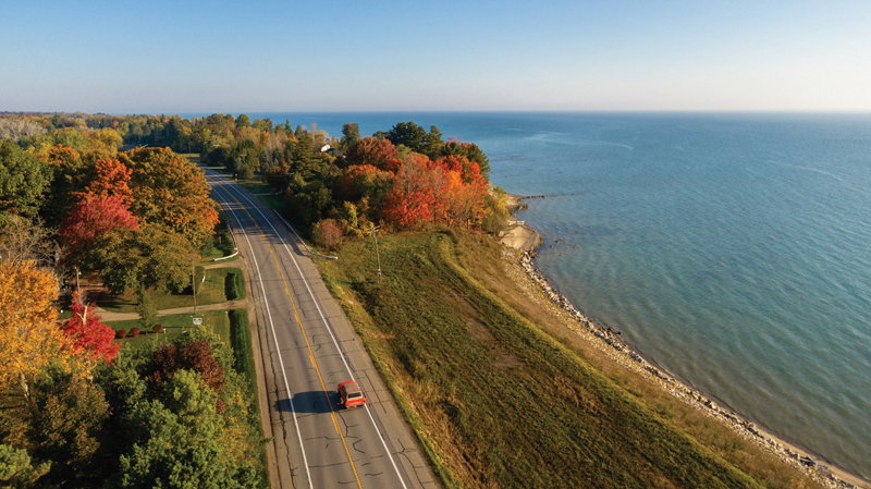
Called Jefferson Avenue to the south, near and through Detroit, and St. Clair River Drive or M-29 farther upstream, this is a compendium of routes that all lead to attractions ranging from dining establishments to farm harvests. The road skirts Lake St. Clair and the St. Clair River from roughly New Baltimore, and then heads north.
People say there’s something inexplicable about the connection between the water and the watery land. Fans of this region say they feel pulled to the islands and narrow streaks of blue water that cut through the world’s largest freshwater delta, and the cute riverside towns you’ll find along the way.
At Algonac State Park, you’re just a few steps from the river — where you can watch up to 19 percent of the world’s fresh water slip by, while passing lake and ocean-going ships cause the ground to vibrate and hum with each propeller turn.
Take the ferry across to Harsens Island, home of a state wildlife refuge; it’s where hundreds of thousands of migrating waterfowl rest up for their southbound journey. If you’re a kayaker, you can enjoy the quiet “highways” and bays that are part of more than 150 miles of water trail routes outlined by the Blueways of St. Clair and the St. Clair Flats State Wildlife Area.
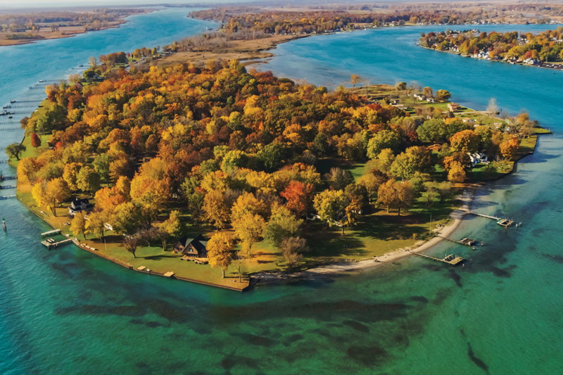
On the island, the menu at Kristin and Tony Bane’s Harsens Island Schoolhouse Grille includes their specialty Shoyu chicken, with hints of Hawaii gathered from Kristin’s time there. A boater’s favorite is Brown’s, on the Middle Channel across from McDonald Island, where typical St. Clair Flats cottages perch on underground pilings and other supports bordering the vast marshland.
You’ll also pass the now-fallow Stewart farm, which has been there since 1815. It’s the site of the island’s annual community Halloween party in mid-October and is also a stop on the St. Clair County Quilt Trail.
Back on the mainland, learn more about this playground for the likes of the Ford, Firestone, and Edison families at the Algonac Maritime Museum, or view passing ships live via the Shipcam. Then stop to replenish at on-the-water spots such as AJ’s Salt Docks, or enjoy the wonderful meals and lodging at either the St. Clair Inn or The River Crab Blue Water Inn.
Farther north and just off M-29, which flows into M-25 at Port Huron, farm stands and fun await at spots such as O’Hair Farms in Croswell. It has cider, pumpkins, a fall corn maze, a sunflower walk, and a zipline. The O’Hair family farms 1,200 acres, 10 of which are used for produce for its serve-yourself stand. Meanwhile, near Jeddo, north of Port Huron, you’ll find The Property Farms and McCallums Orchard and Cider Mill, where you can pick 15 varieties of apples.
At the more-than-12-mile Wadhams to Avoca Trail, you can walk, ride, or blade across the late-1800s 640-foot Mill Creek Trestle, the longest of its type in the state.
For more fun, follow M-25 into the Thumb for vibrant late-fall color viewing at state parks such as Sleeper in Caseville and Port Crescent in Port Austin, a dark sky site.
U. P. D E L I G H T S
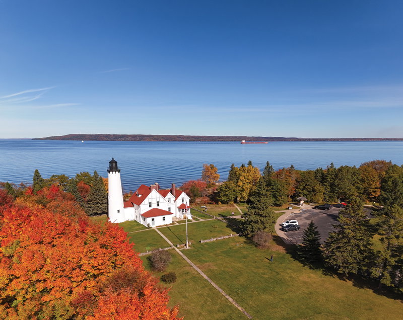
Michigan’s eastern Upper Peninsula holds a treasure of lesser-traveled highways such as M-123 between St. Ignace and Paradise, and a special route that starts in Sault Ste. Marie and hugs Whitefish Bay along Lake Superior.
Highlights of a drive along this road — variously called West Six Mile Road, West Lakeshore Drive, Iroquois Road, and Curley Lewis Highway — include Brimley State Park and the Bay Mills Indian community on Lake Superior’s Waiska Bay. You’ll also see the Point Iroquois Lighthouse, which has guided ships to and from the Soo Locks since 1870. The lighthouse is a great stop for watching the freighter traffic.
Farther west and north, Naomikong Overlook and the 3.2-mile out-and-back Naomikong Point Blue Trail offers a hike to a sandy Lake Superior beach, where, if you’re brave and lucky, you can swim in Superior at its likely warmest temperature of the year.
An easier 1.5-mile route to the beach is just to the west along Lakeshore Drive, and there’s easy beach access a bit farther down the road at a roadside park. The Point Blue Trail crosses a suspension footbridge that’s part of the 4,800-mile North Country Trail, which passes through eight states.
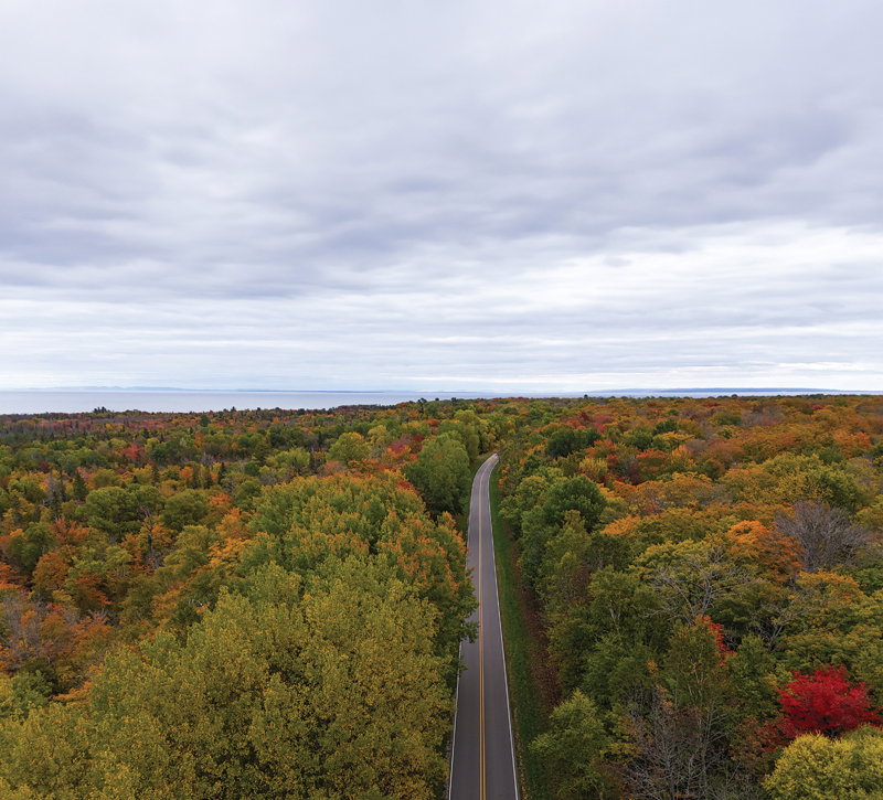
This stretch joins the Tahquamenon Scenic Byway, otherwise known as M-123, on its way to the tip of Whitefish Point, then west toward Tahquamenon Falls and Pictured Rocks National Lakeshore.
TIPS: Fall color often is best in the St. Clair/Algonac area from mid- to late October. In the Upper Peninsula, the colors along Lakeshore Drive and Whitefish Point are often best from late September to mid-October. Driving through the northern Lower Peninsula on I-75 north of Indian River is also majestic in the fall.
Hit the road, and savor the magic of autumn!
Plan It!
Blueways of St. Clair
bluewaysofstclair.org
Discover Michigan’s Thumbcoast
thumbcoast.org
Sault Ste. Marie Convention & Visitors Bureau
saultstemarie.com